
Esri ArcGIS Review
Our score 8.8
What is Esri ArcGIS?
**Review of Esri ArcGIS Software**
As a user and tester of the Esri ArcGIS software, I am thoroughly impressed with its capabilities and features. It is a powerful GIS (Geographic Information System) software that provides a comprehensive suite of tools for mapping, analyzing, and visualizing geographical data. Whether you are a beginner or an experienced user, ArcGIS offers a user-friendly interface and a range of advanced functionalities that make it a top choice in the field of GIS software.
**Impressive Functionality and Tools**
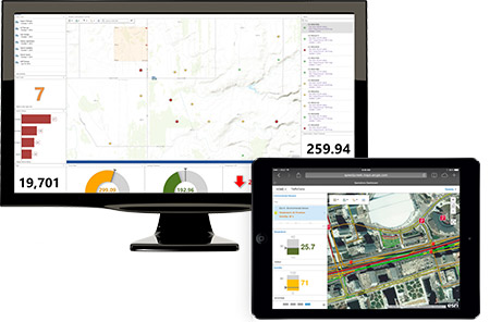
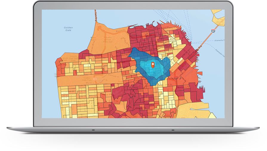
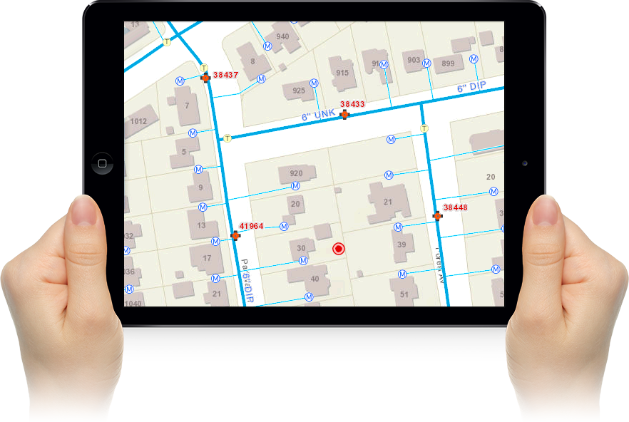
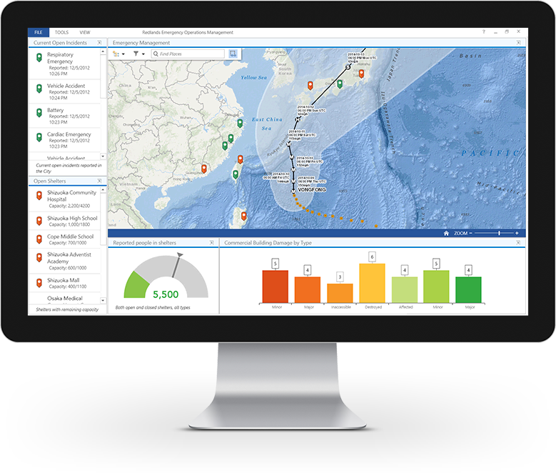
The Esri ArcGIS software offers a wide range of functionality and tools that aid in data analysis, mapping, and spatial analysis. With its robust geoprocessing tools, users can easily manipulate and analyze geospatial data to gain valuable insights. Additionally, ArcGIS provides a vast collection of pre-built analysis and mapping tools, allowing users to perform complex spatial analyses with ease. The software also offers advanced visualization options, including 3D mapping, which enhances the overall user experience and makes the interpretation of spatial data more intuitive.
**User-Friendly Interface**
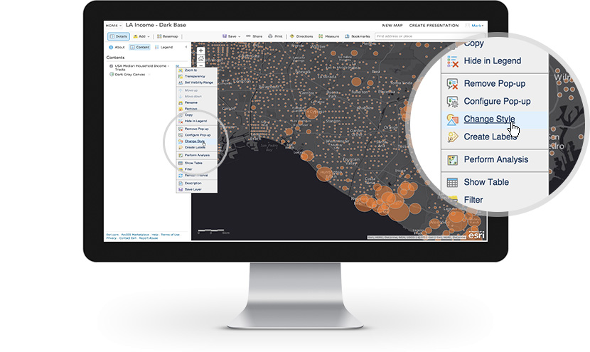
One of the standout features of Esri ArcGIS is its user-friendly interface. The software is designed to be intuitive and easy to navigate, making it accessible for both novice and advanced users. The layout of the interface is clean and organized, with clearly labeled tabs and menus that allow for efficient workflow management. Additionally, the software provides helpful tooltips and guidance throughout the process, ensuring that users can quickly become familiar with the various tools and functionalities.
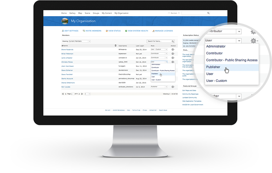
**Highly Customizable**
ArcGIS offers a high level of customization, allowing users to tailor the software to their specific needs. The software supports customization through scripting and programming, enabling users to create custom tools, workflows, and interfaces. This flexibility is particularly beneficial for users who require specialized functionalities that are not available out of the box. The ability to customize ArcGIS ensures that users can adapt the software to fit their unique requirements and seamlessly integrate it into their existing workflows.
**Impressive User Feedback**
Esri ArcGIS has garnered positive reviews from users across various industries. Here are a few quotes from other users:
- "ArcGIS has transformed the way we analyze and visualize our geographical data. The software is highly intuitive and allows us to perform complex spatial analyses with ease." - John, Environmental Consultant
- "As an urban planner, ArcGIS is an essential tool for me. Its powerful geoprocessing tools and advanced visualization capabilities have revolutionized the way we plan and develop cities." - Sarah, Urban Planner
- "ArcGIS has been invaluable in our company's decision-making process. The software's spatial analysis tools have helped us identify new market opportunities and optimize our business strategies." - Michael, Business Analyst
**Key Features of Esri ArcGIS**
- Comprehensive GIS functionality
- Robust geoprocessing tools
- Advanced mapping and visualization options
- Customization through scripting and programming
- User-friendly interface
- Broad range of data format support
- Collaboration and sharing capabilities
- Integration with other systems
**FAQ (Frequently Asked Questions)**
**Q: Is Esri ArcGIS suitable for beginners in the field of GIS?**
A: Yes, Esri ArcGIS is designed to be accessible for users of all skill levels. The software provides a user-friendly interface and intuitive tools, making it suitable for beginners in the field of GIS.
**Q: Can I customize Esri ArcGIS to fit my specific needs?**
A: Absolutely! Esri ArcGIS offers a high level of customization. Users can customize the software through scripting and programming, allowing for the creation of custom tools, workflows, and interfaces.
**Q: Can I collaborate and share my GIS projects with others using ArcGIS?**
A: Yes, ArcGIS provides collaboration and sharing capabilities. Users can easily collaborate with team members, share their GIS projects, and work together on data analysis and visualization.
**Q: Does ArcGIS support a wide range of data formats?**
A: Yes, ArcGIS supports a broad range of data formats, including shapefiles, geodatabases, CAD files, and various raster formats. This ensures compatibility with diverse data sources and allows for seamless integration of data into your GIS projects.
Overall, Esri ArcGIS is a highly capable GIS software that offers a comprehensive suite of tools, a user-friendly interface, and the ability to customize and integrate with other systems. Whether you are an environmental consultant, urban planner, or business analyst, ArcGIS provides the tools and functionalities necessary to analyze, visualize, and interpret geographical data effectively.
Overview of Esri ArcGIS
Overview of Esri ArcGIS Features
- Spatial Analysis & Data Science
- Imagery & Remote Sensing
- 3D GIS
- Field Operations
- Real-Time Visualization & Analytics
- Mapping
- Data Collection & Management
Gallery
Videos
Downloads
Pricing Plans
$$$
Per year/per user
$$$
1,000 credits
Add New Comment