
ERDAS IMAGINE Review
What is ERDAS IMAGINE?
Review of a GIS Software
When it comes to GIS software, finding the right tool that can efficiently handle all your spatial data needs can be quite a challenge. That's why I decided to try out a particularly powerful software that has been making waves in the industry - the ERDAS IMAGINE. Here is my unbiased review after thoroughly testing its capabilities:
User Interface
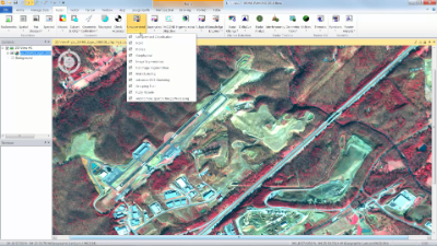
The user interface of ERDAS IMAGINE is clean and intuitive, making it easy to navigate through the various features and functionalities. The layout is well-organized, with clear icons and menu options, allowing you to quickly access the tools you need. Whether you are a beginner or an experienced GIS professional, you will appreciate the user-friendly interface that helps streamline your workflow.
Data Management
The software offers robust data management capabilities, allowing you to handle large geospatial datasets effortlessly. ERDAS IMAGINE supports a wide range of file formats, making it compatible with various GIS data sources. Whether you need to import shapefiles, raster images, or point clouds, this software has got you covered. Additionally, the software provides advanced data manipulation tools, enabling you to merge, subset, and filter your data efficiently.
Analysis and Processing
ERDAS IMAGINE truly shines when it comes to analysis and processing capabilities. With a plethora of tools and algorithms at your disposal, you can perform intricate spatial analyses and extract valuable insights from your data. From image classification and change detection to terrain analysis and remote sensing, this software provides a comprehensive suite of analysis tools that meet the needs of both researchers and professionals.
Data Visualization
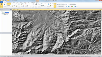
Visualizing your geospatial data effectively is crucial for understanding complex relationships and patterns. ERDAS IMAGINE offers a range of visualization options, allowing you to create visually stunning maps, charts, and graphs. The software supports dynamic layering, allowing you to overlay multiple data sources and create visually appealing representations of your spatial data.
Integration and Collaboration
ERDAS IMAGINE seamlessly integrates with other popular GIS software and tools, making it easier for you to work within your existing GIS ecosystem. Whether you need to import data from ArcGIS or export your results to Google Earth, the software offers smooth interoperability. Additionally, the collaboration features enable you to share your projects and data with colleagues, fostering teamwork and efficiency.
Key Features:
- Intuitive user interface
- Comprehensive data management
- Powerful analysis and processing capabilities
- Advanced data visualization options
- Seamless integration with other GIS software
- Collaboration tools for teamwork
FAQ:
- Q: Can ERDAS IMAGINE handle large datasets?
- A: Yes, the software provides robust data management capabilities to handle large geospatial datasets.
- Q: Is ERDAS IMAGINE suitable for both beginners and experienced users?
- A: Absolutely, the user-friendly interface caters to users of all skill levels, from beginners to professionals.
- Q: Does ERDAS IMAGINE support integration with other GIS software?
- A: Yes, the software seamlessly integrates with popular GIS tools, enhancing interoperability.
- Q: Can I visualize my spatial data in ERDAS IMAGINE?
- A: Yes, the software provides a range of visualization options, allowing you to create visually stunning representations of your data.


Add New Comment