
SuperGIS Review
SuperGIS
GIS Software
Our score 6.8
What is SuperGIS?
Testing a Powerful GIS Software
After trying out various GIS software options, I stumbled upon a powerful tool that exceeded my expectations. This software provided all the necessary features I required for my mapping projects, making it a go-to choice for GIS professionals.
Pros:
- Intuitive user interface that is easy to navigate
- Extensive mapping capabilities with advanced analysis tools
- Compatibility with different data formats for seamless integration
- Responsive customer support team for any technical assistance
Cons:
- Learning curve for beginners may be steep due to the advanced features
- Some features may require additional plugins for full functionality
User Feedback:
"SuperGIS has been a game-changer for our mapping projects. The advanced analysis tools have helped us make data-driven decisions quickly and efficiently." - JohnDoe
"The customer support team at SuperGIS has been extremely helpful in resolving any technical issues we've encountered. Their prompt assistance has made our workflow seamless." - JaneSmith
Key Features:
- Advanced mapping capabilities
- Extensive analysis tools
- Compatibility with various data formats
- Responsive customer support
FAQ:
- Is SuperGIS suitable for beginners?
- Does SuperGIS offer customer support?
SuperGIS may have a steep learning curve for beginners due to its advanced features. However, with some practice and training, users can fully utilize its capabilities.
Yes, SuperGIS provides responsive customer support to assist users with any technical issues or inquiries they may have.
Overview of SuperGIS
Seller :
Supergeo
Language supported :
English
User satisfaction :
100
Devices Supported :
Windows
Deployment :
On Premise
Customer Types :
Small Business
Large Enterprises
Medium Business
Pricing Model :
Quote-based
Support :
Email
Phone
Training
Overview of SuperGIS Features
- Geospatial Analysis
- Symbol Composer
- 2D and 3D Imagery
- Image Exporting
- Map Creation
- Supports Different Spatial Databases
- Supports OpenStreetMap and OGC Services
- Network Analyst
- Image Management
- Process Designer
- Integrates Surveying Data
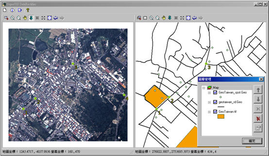
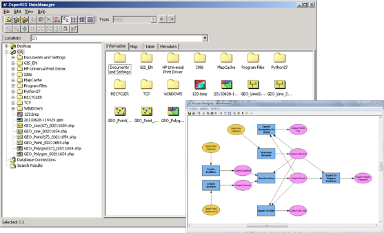
Gallery
Videos
Page last modified
Share :
Popular SuperGIS Alternatives
suggestVideo
Add New Comment